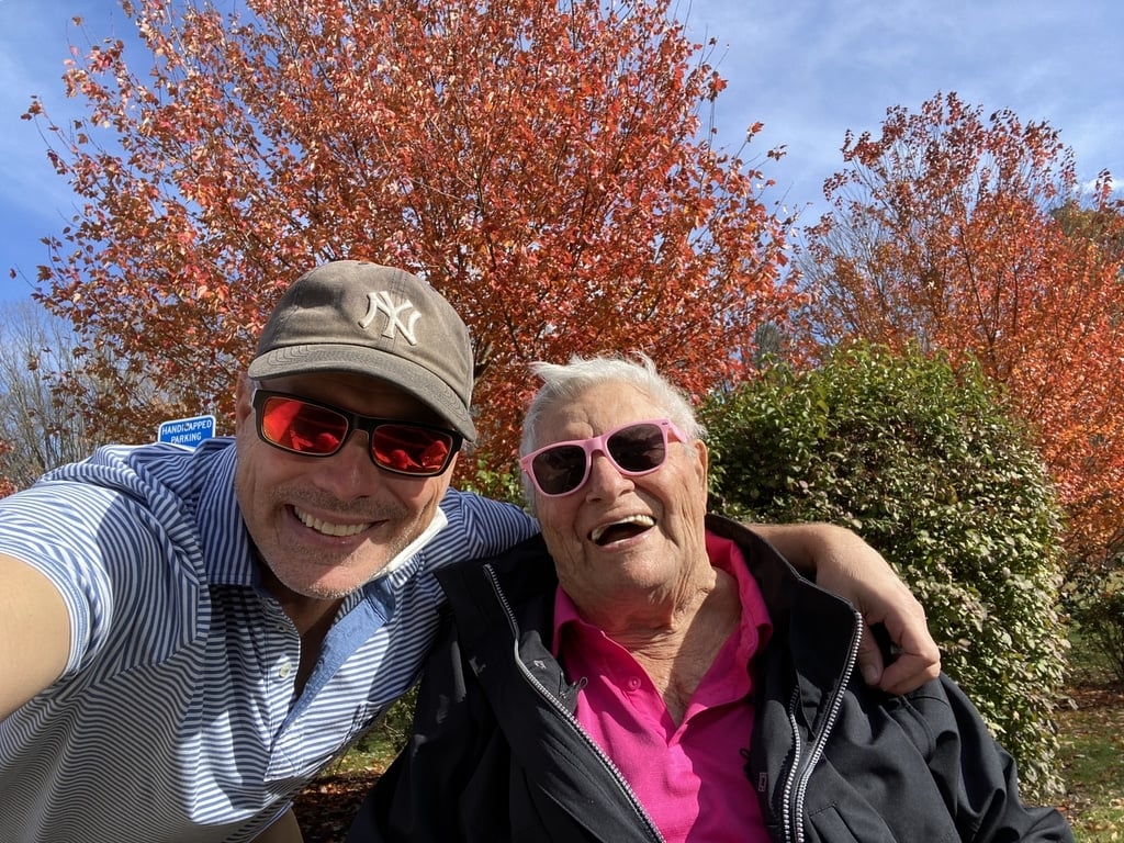
I grew up in Southern Connecticut and without a doubt, the prettiest time of the year there is autumn. The reds, oranges and yellows of the trees in peak leaf-peeping season are just as spectacular as they are in other parts of the country. The photo below is one that I took with my beloved late father one November when I surprised him with a visit.
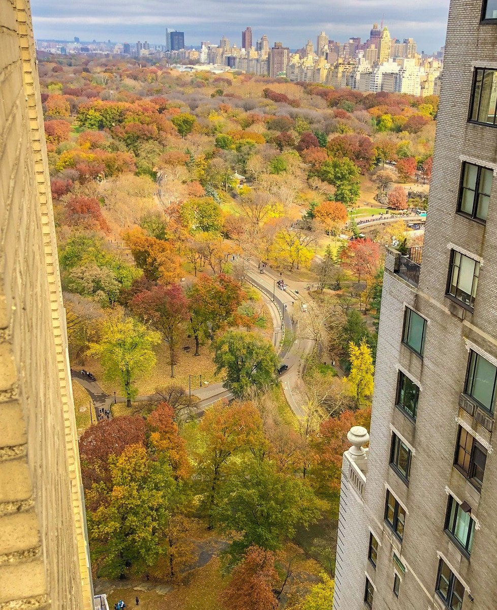
 Better yet, the photo below, is from New York City’s Central Park, which is just 42 miles from where I grew up. I took this photo on November 20, 2018 from the JW Essex House Hotel.
Right now is a good time to start planning a leaf-peeping trip. I don’t usually recommend traveling anywhere last-minute since it tends to cost more but timing a fall foliage trip can be tricky since no one really knows when the leaves are going to start to change except Mother Nature.
We all know that weather patterns have been changing so the tricky part of any fall foliage trip is getting the timing right. That’s where Explorefall.com or SmokyMountains.com‘s annual fall foliage map comes into play. They have just released their interactive 2025 map, which breaks down the continental U.S. into counties and uses a blend of sources to predict when that county’s trees will be in peak color. To use it, you just move the slider at the bottom of the map from left to right. As you move the slider, you’ll see the map change colors in accordance with the date.
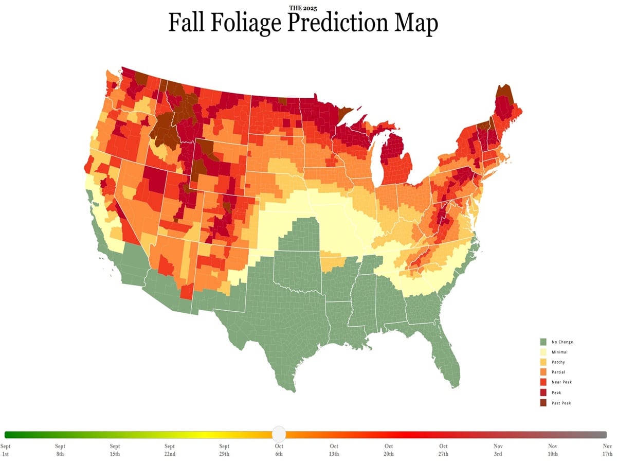
How accurate is this fall foliage map?
My sister was in Vermont last year when this map showed it was one of the few places in the country where the leaves had already started to change, and she confirmed it was true. No matter what, this is a fun tool to play around with and as far as I can tell, it’s one of the best predictors of fall color you’ll find anywhere. The data powering this interactive fall foliage map includes, among other sets, NOAA historical temperature data, NOAA historical precipitation data, NOAA temperature forecasts, NOAA precipitation forecasts, historical leaf peak trends, and peak observation trends. Give it a try for yourself and start planning your perfectly-timed leaf-peeping road trip.
KEEP READING:
–12 Passport Tips That Will Save You Time, Money and Headaches
–The Most Important Thing I Do When I Travel Internationally Is …
–Rick Steves Got Pickpocketed in Paris: Here’s What He Wants You to Know
–The Most Important Thing For Travelers to Do According to a Safety Expert
–What You Need To Know About Renewing or Getting an Emergency Passport in the U.S.
Want more travel news, tips and deals? Sign up to Johnny Jet’s free newsletter and check out these popular posts: The Travel Gadget Flight Attendants Never Leave Home Without and 12 Ways to Save Money on Baggage Fees. Follow Johnny Jet on MSN, Facebook, Instagram, Pinterest, and YouTube for all of my travel posts.