 One of the biggest pet peeves in travel is noise. I’ve come to learn to never travel without ear plugs, earbuds and either a soothing sound machine or sound app that has sounds like heavy rain or ocean waves. There have been times when I’ve wanted to get away from all noise so badly that I’ve booked a hotel away from major streets/freeways/train tracks—only to later discover it was right below a flight path.
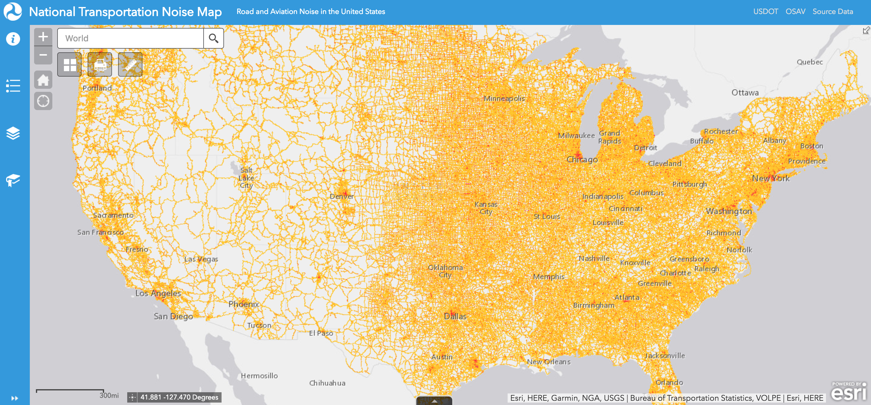
Well, thanks to the Department of Transportation, there’s now a map that’s color-coded to show the worst areas for aircraft and automobile noise in major metro areas. Users can zoom in and out of the National Transportation Noise Map and search by location. There are also layers you can turn on and off, like “the worst areas for aircraft noise in major metro areas.” (You might need to uncheck this first so you can see the address or area you’re looking up and then check it again so you can see what the noise level is.) Red is heavy traffic and can found by major airports and roadways.
According to the DOT’s website, “The layers will be updated on an annual basis, and future versions of the National Transportation Noise Map are envisioned to include additional transportation noise sources, such as rail and maritime.”
Sources: U.S. Department of Transportation, Bureau of Transportation Statistics, National Transportation Noise Map; U.S. Census Bureau, 2014 American Community Survey 5-year Estimates; National Institute on Deafness and Other Communication Disorders, I Love What I Hear! Common Sounds, available here.


